Custom Maps and electronic resources
Browse resources available to download and use for your classroom here! If you cannot find what you need or would like to get a map printed, submit a request below.

OKAGE Custom Maps in the Classroom!
Please use this form to request free resources for your school or to have a specific electronic map created for you.
OKAGE Library materials are distributed on a first come, first served basis. Once you have filled out this form, OKAGE will contact you to let you know if the resource you requested is available, and arrange delivery details if applicable. Please allow ample time for the maps to be created and printed.

Click the image to view an interactive map of light pollution in Oklahoma.
Source: Lightpollutionmap.info

Click the image to view a collection of Oklahoma highway and tourism maps.
Source: Travel Oklahoma

Click the image to download a map of groundwater resources in Oklahoma. The default size for printed copies of this map is three feet by four feet.
Source: Oklahoma Geological Survey

Click the image to download a map of earthquakes in Oklahoma from 1900-1978. The default size for printed copies of this map is three feet by four feet.
Source: Oklahoma Geological Survey

Click on the image to download a map of crude oil pipelines in Oklahoma. The default size for printed copies of this map is three feet by four feet.
Source: Oklahoma Geological Survey

Click on the image to download a map of Oklahoma oil and gas fields as of 2015. The default size for printed copies of this map is three feet by four feet.
Source: Oklahoma Geological Survey

Click on the image to view a collection of maps about population data in Oklahoma. The default size for printed copies of this map is three feet by four feet.
Source: US Census Bureau

Click on the image to download a map of Oklahoma climate divisions. The default size for printed copies of this map is three feet by four feet.
Source: Oklahoma Climatological Survey

Click on the image to download a map of normal annual snowfall in Oklahoma. The default size for printed copies of this map is three feet by four feet.
Source: Oklahoma Climatological Survey

Click on the image to download a map of normal annual precipitation in Oklahoma. The default size for printed copies of this map is three feet by four feet.
Source: Oklahoma Climatological Survey
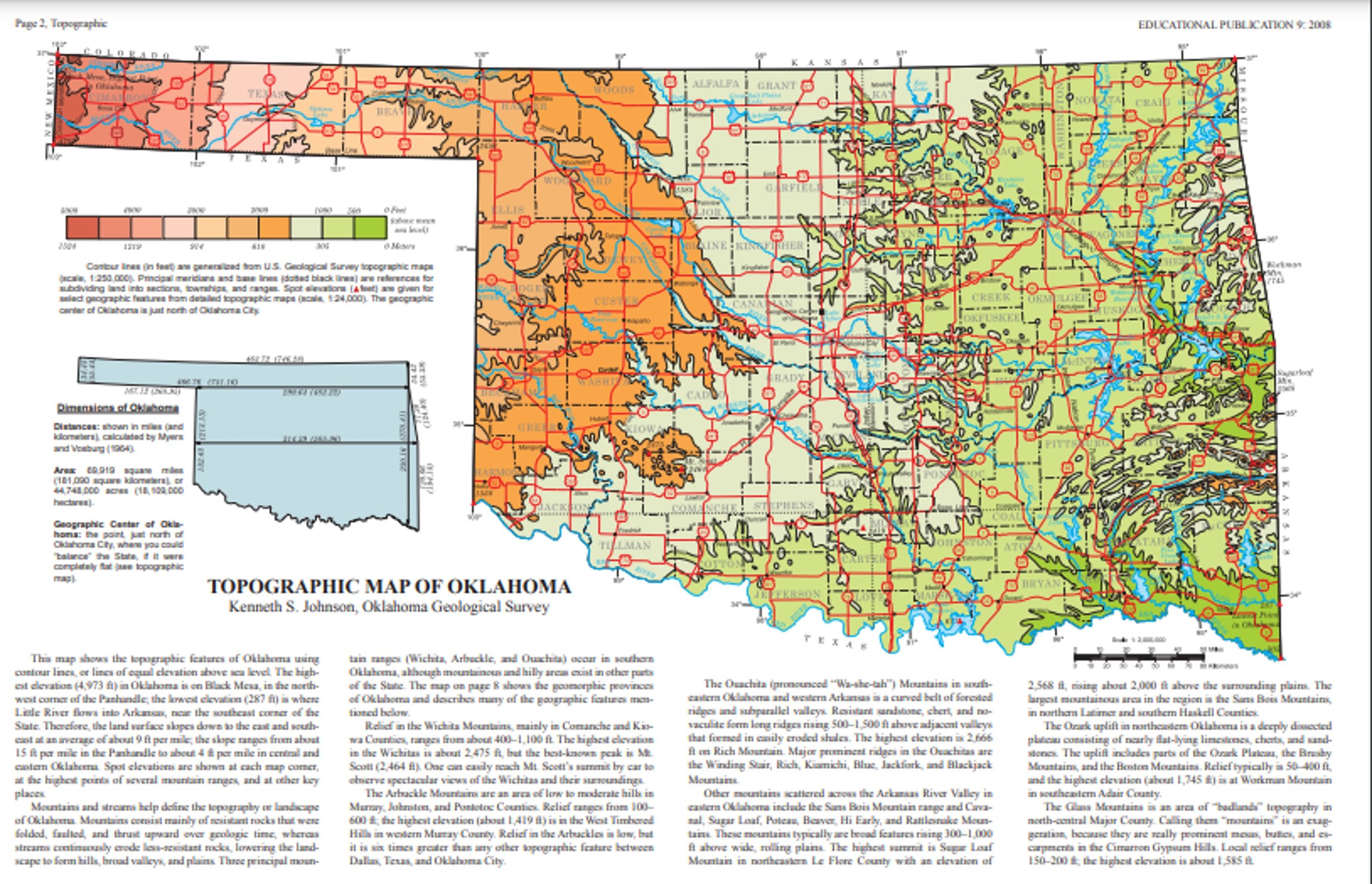
Click on the image to download a topographic map of Oklahoma. The default size for printed copies of this map is three feet by four feet.
Source: Oklahoma Geological Survey

Click on the image to download a tectonic map of Oklahoma. The default size for printed copies of this map is three feet by four feet.
Source: Oklahoma Geological Survey

Click on the image to download a geological map of Oklahoma. Please allow a moment for this map to load due to the file size. The default size for printed copies of this map is three feet by four feet.
Source: Oklahoma Geological Survey

Click on the image to download a map of the tribal jurisdictions in the state of Oklahoma. The default size for printed copies of this map is three feet by four feet.
Source: Oklahoma Department of Transportation (ODOT), Planning and Research Division
Click on the image to download a map of Oklahoma’s major roadways and routes.
Source: Oklahoma Department of Transportation

Click on the image to download a map of Oklahoma’s counties. This map was created by Noah Holderbaum, OKAGE Student Assistant. The default size for printed copies of this map is three feet by four feet.
Click on the image to download a map of Oklahoma’s cities and towns. This map was created by Noah Holderbaum, OKAGE Student Assistant. The default size for printed copies of this map is three feet by four feet.

Click on the image to download a map of tourism in Oklahoma. This map was created by Noah Holderbaum, OKAGE Student Assistant. The default size for printed copies of this map is three feet by four feet.

Click on the image to download a map of All-Black Towns in Oklahoma. This map was created by Noah Holderbaum, OKAGE Student Assistant. The default size for printed copies of this map is three feet by four feet.
Click on the image to download a map of Oklahoma’s counties. The default size for printed copies of this map is three feet by four feet.
Source: US Census Bureau
Click on the image to download a satellite map of the Western Hemisphere. This map was created by Noah Holderbaum, OKAGE Student Assistant. The default size for printed copies of this map is four feet by three feet.
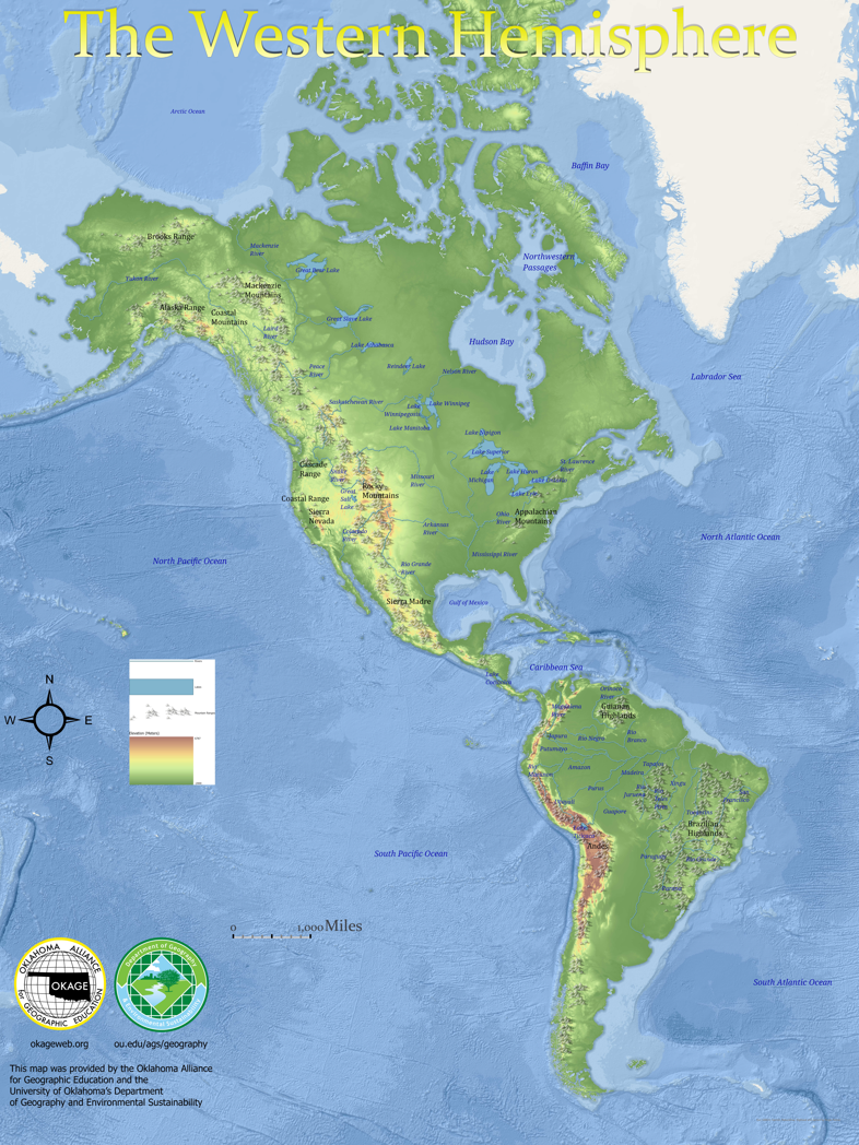
Click on the image to download a physical map of the Western Hemisphere. This map was created by Noah Holderbaum, OKAGE Student Assistant. The default size for printed copies of this map is four feet by three feet.
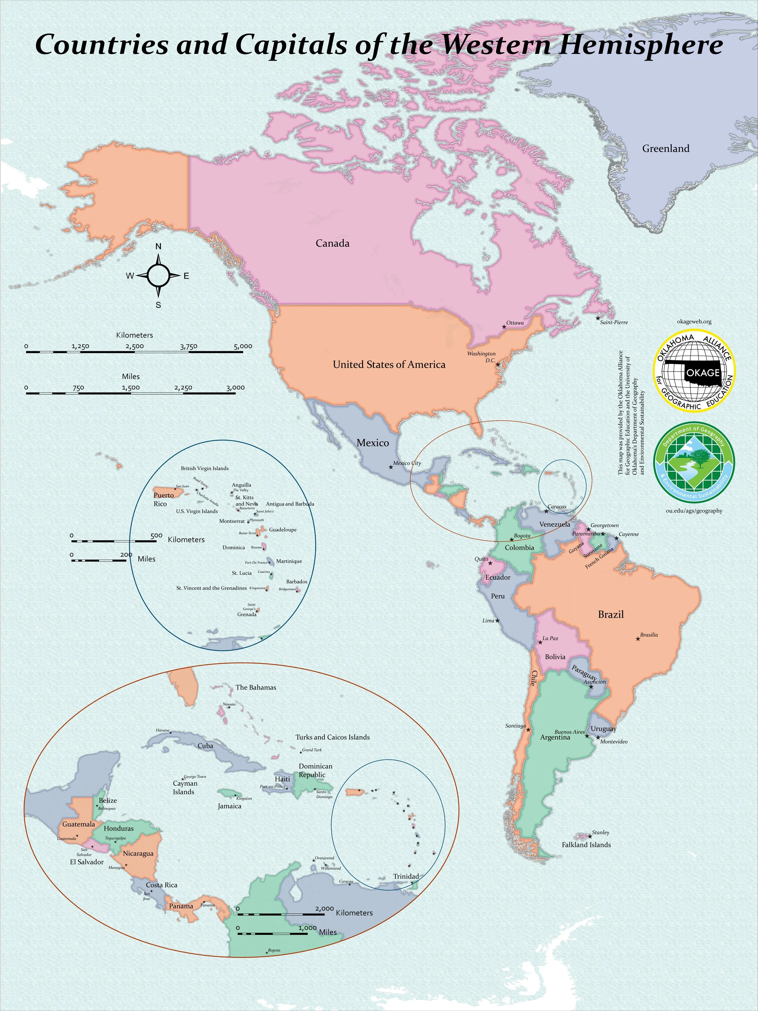
Click on the image to download a political map of the Western Hemisphere. This map was created by Noah Holderbaum, OKAGE Student Assisstant. The default size for printed copies of this map is four feet by three feet.

Click on the image to download a physical map of Canada. This map was created by the University of Oklahoma Center for Spatial Analysis. The default size for printed copies of this map is three feet by four feet.

Click on the image to download a political map of Canada. This map was created by the University of Oklahoma Center for Spatial Analysis. The default size for printed copies of this map is three feet by four feet.
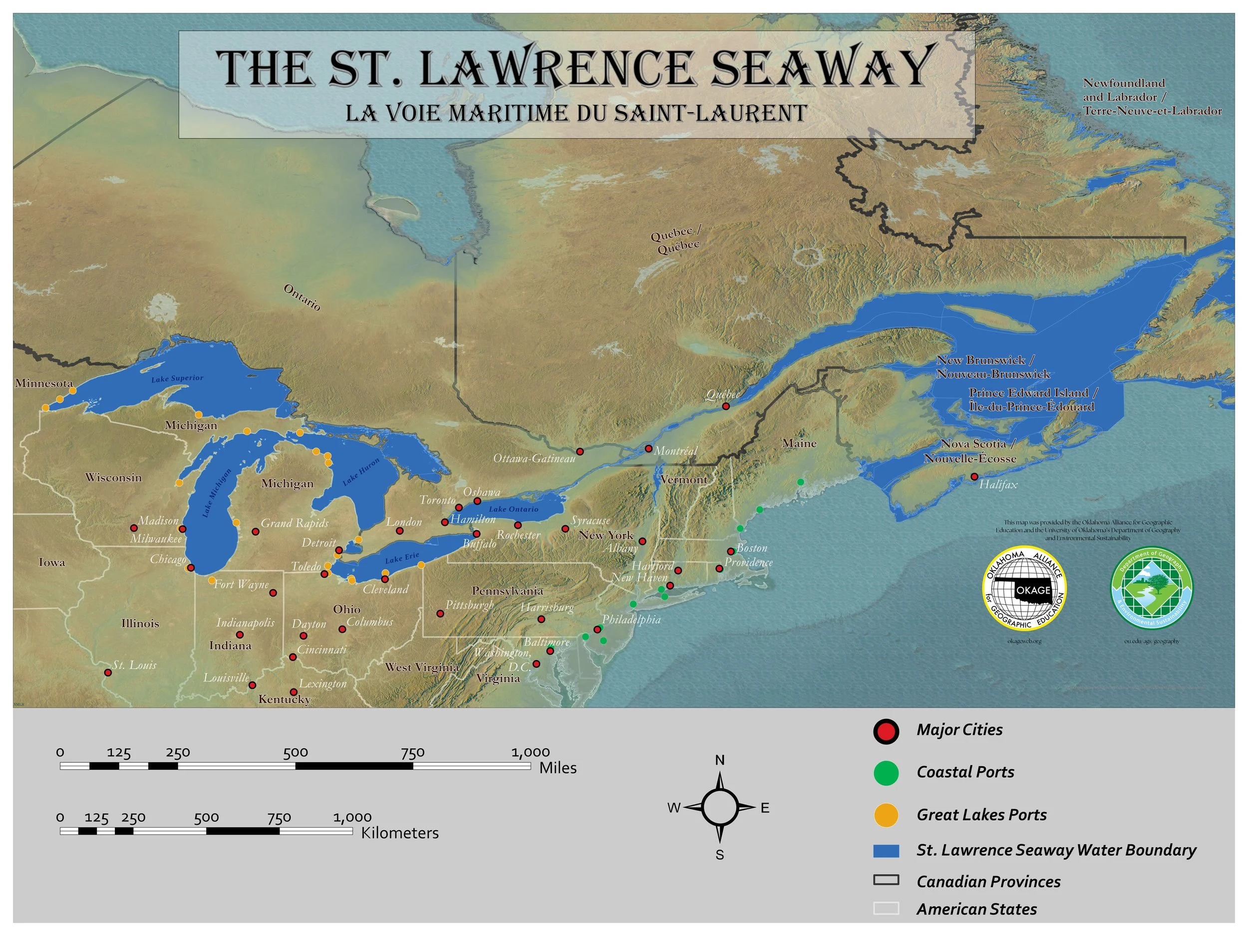
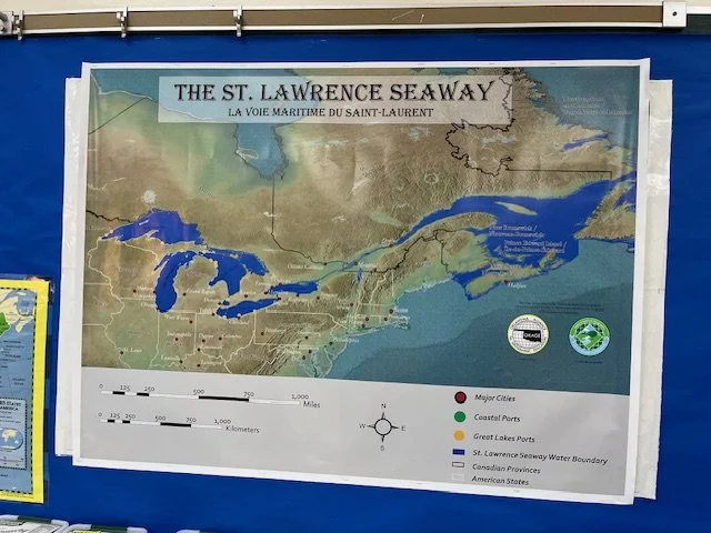
Click on the image to download a map of the St. Lawrence Seaway. This map was created by Noah Holderbaum, OKAGE Student Assistant. The default size for printed copies of this map is three feet by four feet.

Click on the image to download the Space Shuttle Earth Observations Project Physiographic Atlas. This atlas is the second edition and was produced in December 1991. It was prepared and published by the Defense Mapping Agency Aerospace Center in St. Louis, Missouri for the National Aeronautics and Space Administration.

Click on the image to download the Defense Mapping Agency Aerospace Center star charts and keys.
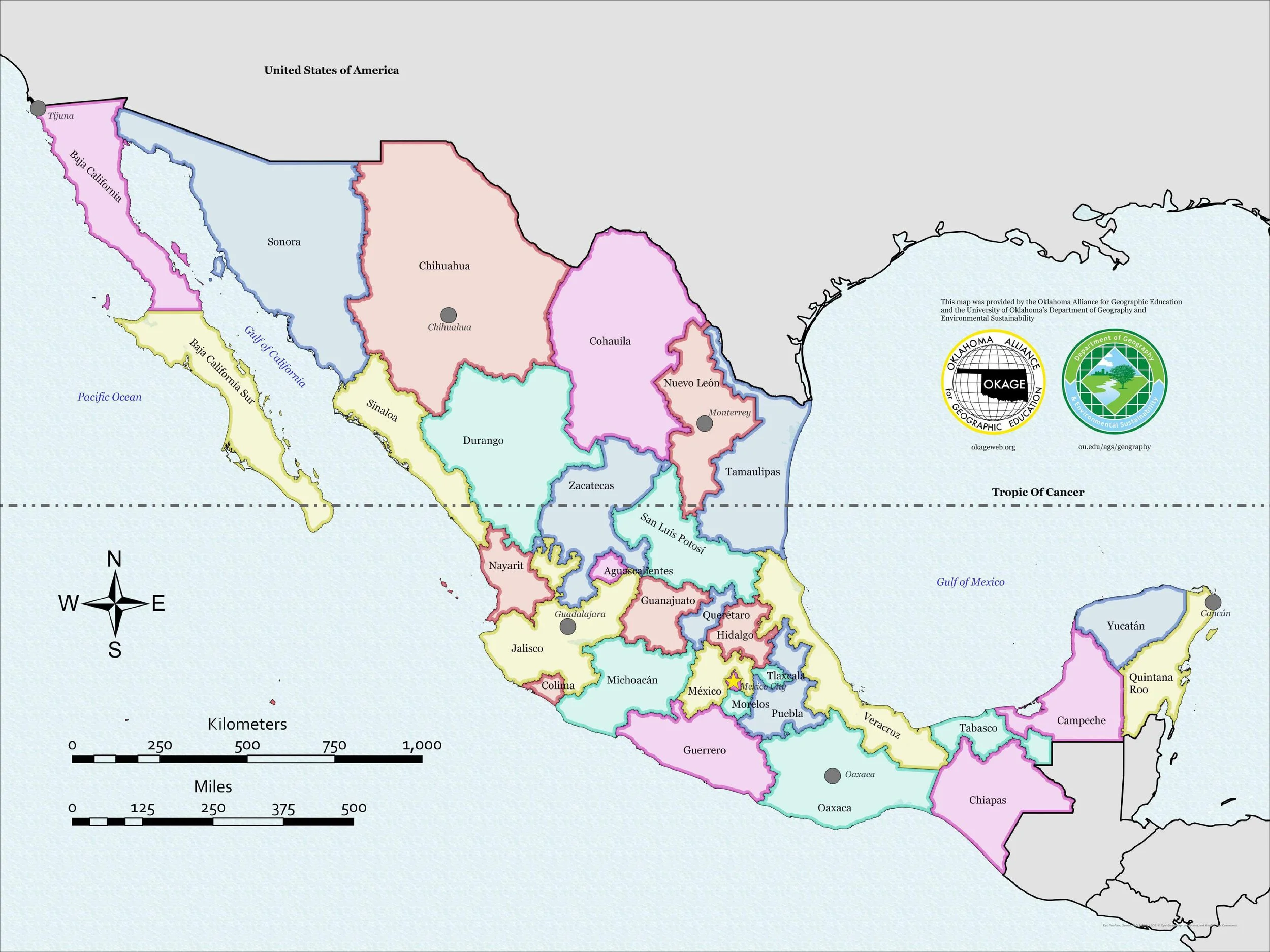
Click on the image to access a political map of Mexico. This map was created by Noah Holderbaum, OKAGE Student Assistant. The default size for printed copies of this map is three feet by four feet.
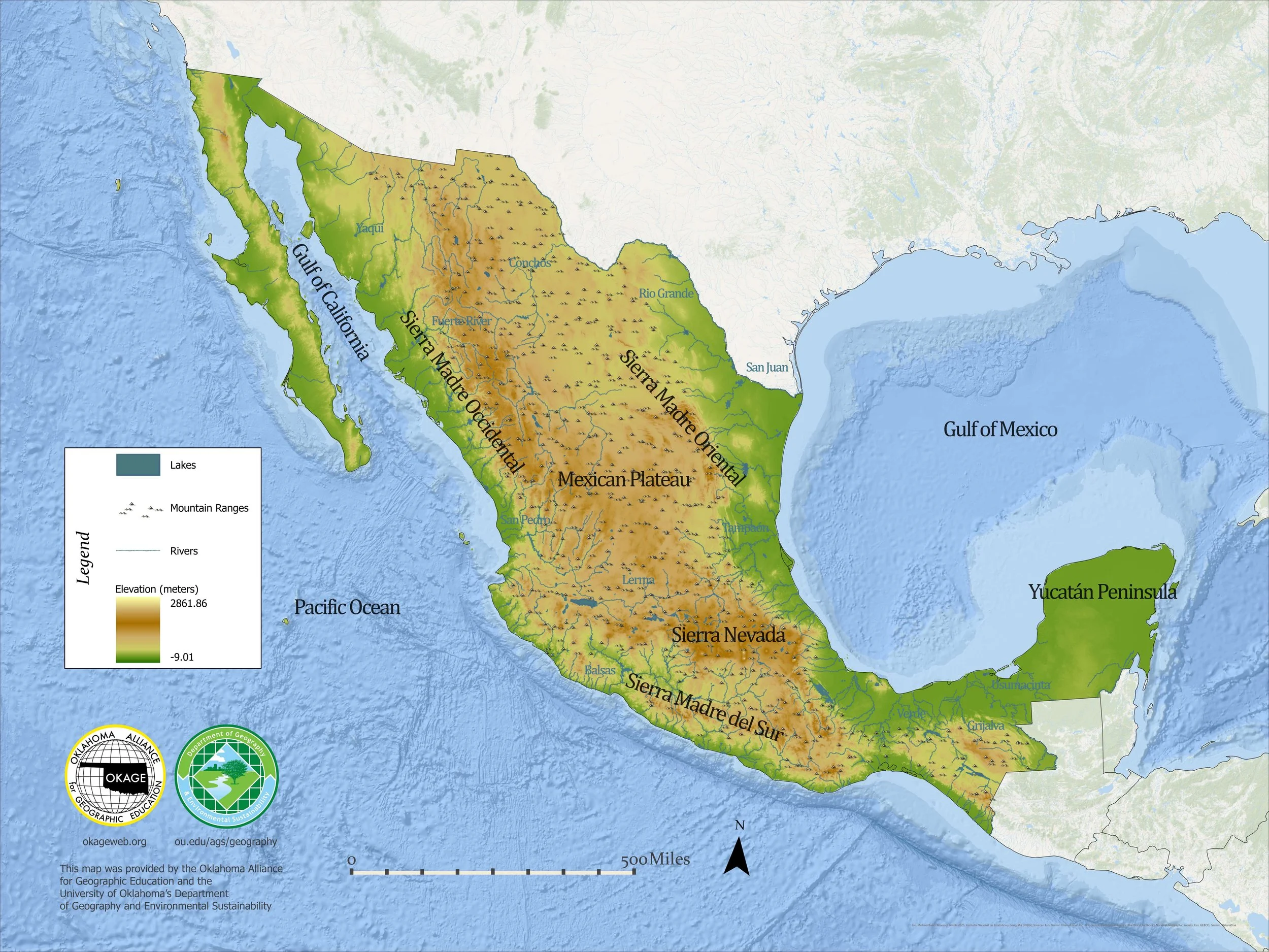
Click on the image to access a physical map of Mexico. This map was created by Noah Holderbaum, OKAGE Student Assistant. The default size for printed copies of this map is three feet by four feet.
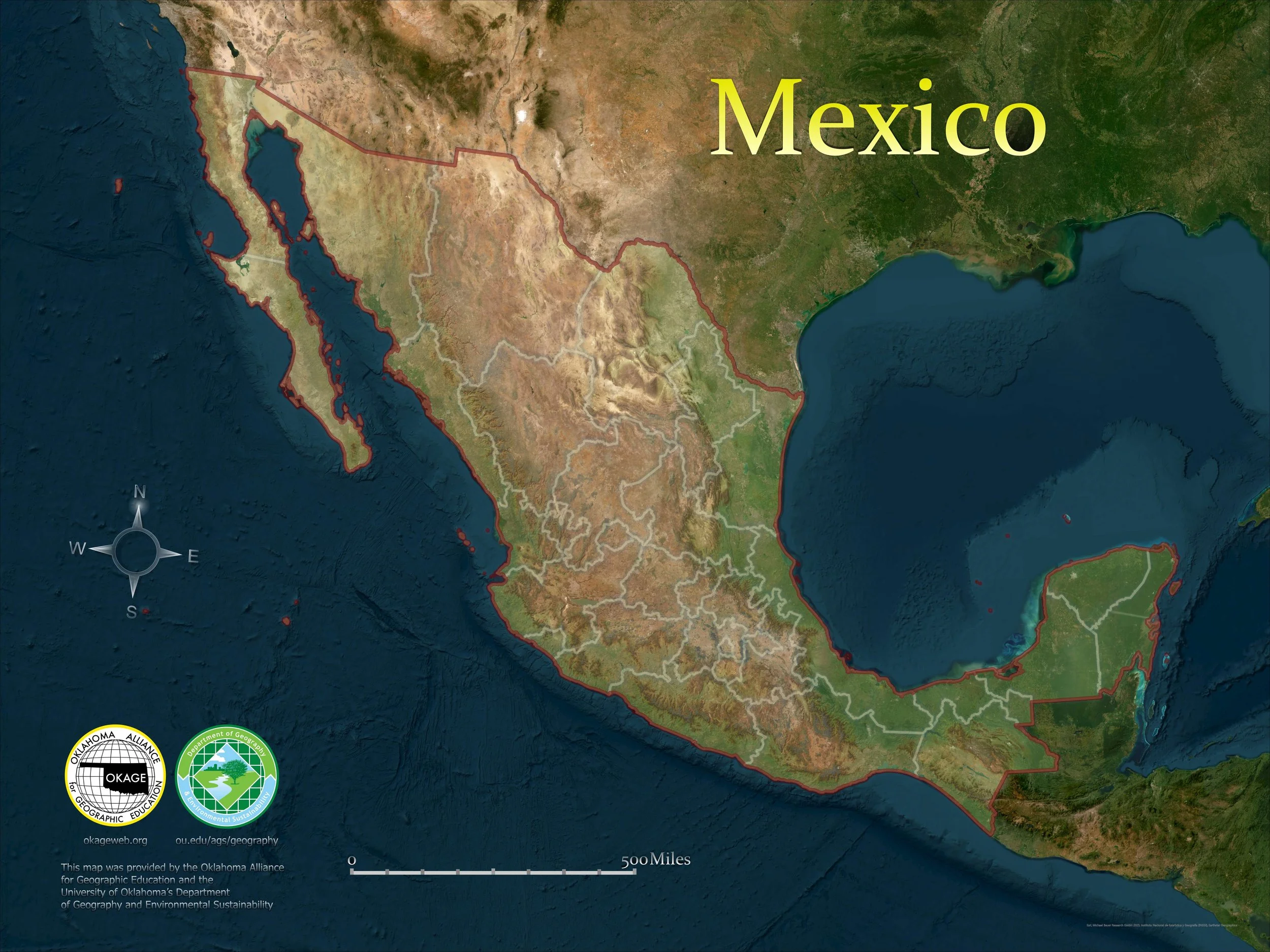
Click on the image to access a satellite map of Mexico. This map was created by Noah Holderbaum, OKAGE Student Assistant. The default size for printed copies of this map is three feet by four feet.
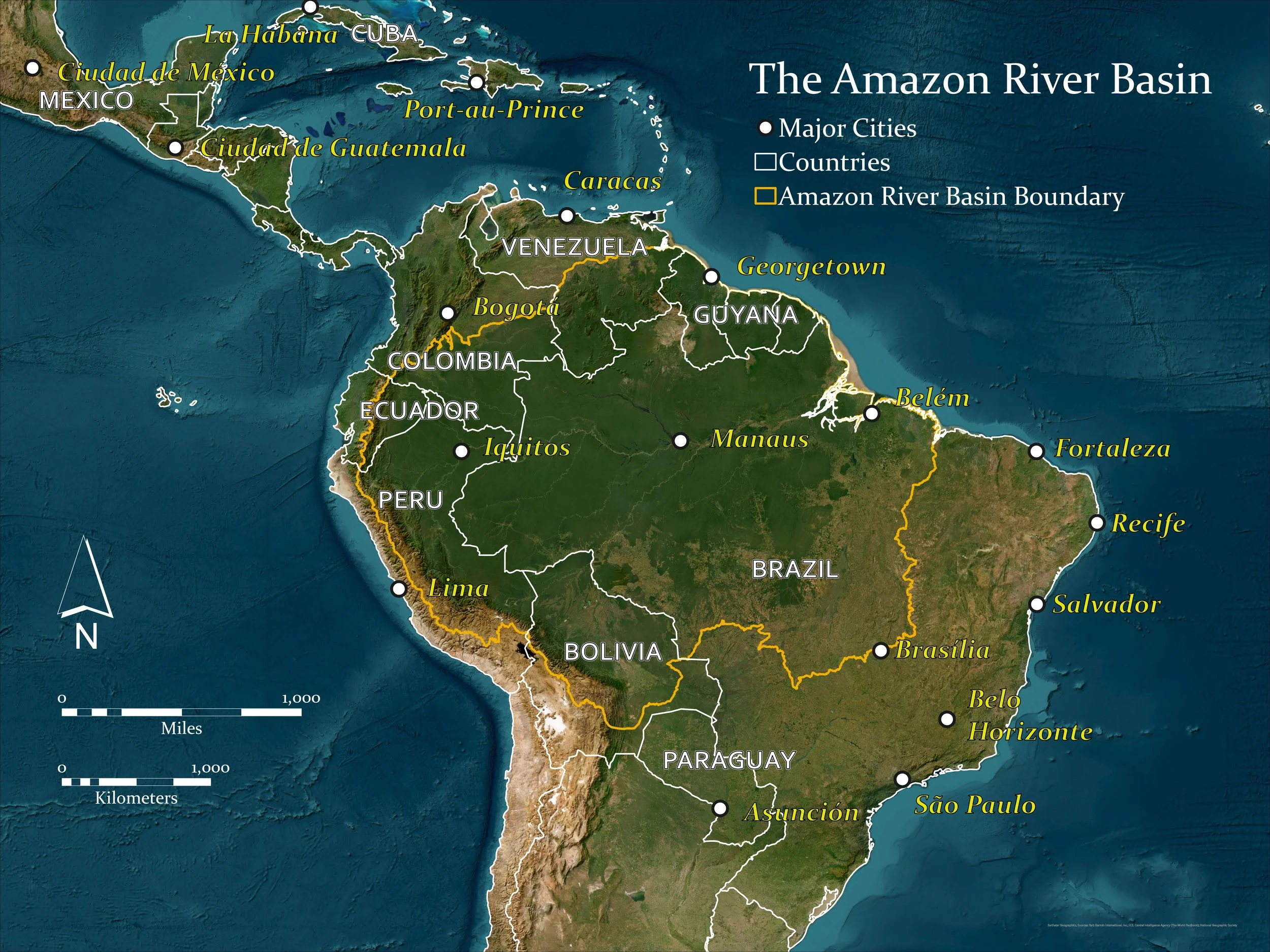
Click on the image to access a map of the Amazon River Basin. This map was created by Noah Holderbaum, OKAGE Student Assistant, to provide a poster version of the interactive map below. The default size for printed copies of this map is three feet by four feet.

Click on the image to access an online interactive map of the Amazon River Basin. This map was created by the University of Oklahoma Center for Spatial Analysis.

Click on the image to download this physical world map. This map was created by the University of Oklahoma Center for Spatial Analysis. The default size for printed copies of this map is three feet by four feet.

Click on the image to download a physical map of the United States. This map was created by the University of Oklahoma Center for Spatial Analysis. The default size for printed copies of this map is three feet by four feet.

Click on the image to download a political map of the world. This map was created by the University of Oklahoma Center for Spatial Analysis. The default size for printed copies of this map is three feet by four feet.

Click on the image to download a political map of the United States. This map was created by the University of Oklahoma Center for Spatial Analysis. The default size for printed copies of this map is three feet by four feet.

Click on the image to download a political map of the Thirteen Colonies. This map was created by the University of Oklahoma Center for Spatial Analysis. The default size for printed copies of this map is three feet by four feet.

Click on the image to download a map of the 2020 electoral college votes. This map was created by the University of Oklahoma Center for Spatial Analysis. The default size for printed copies of this map is three feet by four feet.
Click on the image to download a map of the 2020 electoral college. This map was created by the University of Oklahoma Center for Spatial Analysis. The default size for printed copies of this map is three feet by four feet.

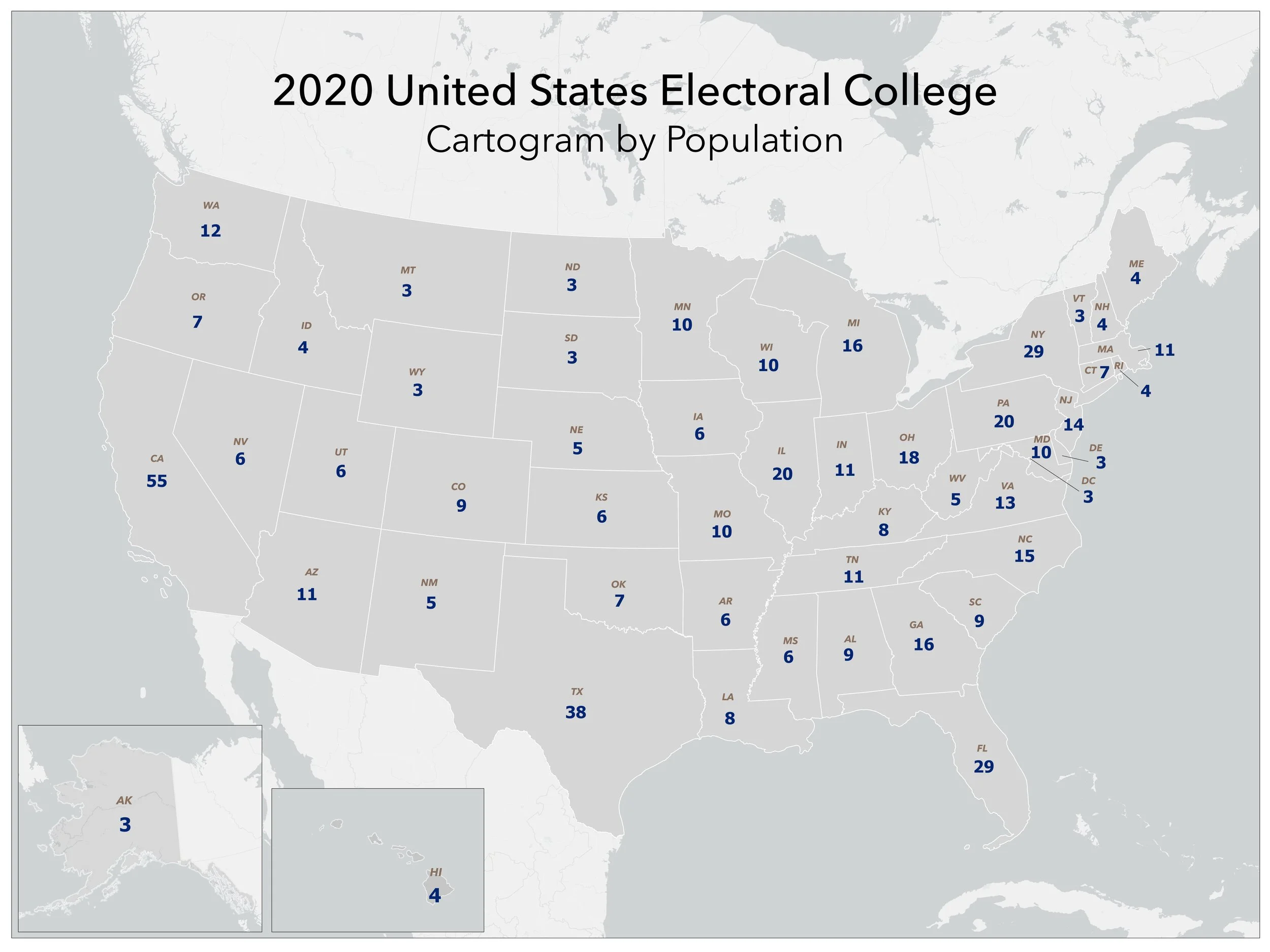
Click on the image to download a cartogram of the electoral college by state population. This map was created by the University of Oklahoma Center for Spatial Analysis. The default size for printed copies of this map is three feet by four feet.
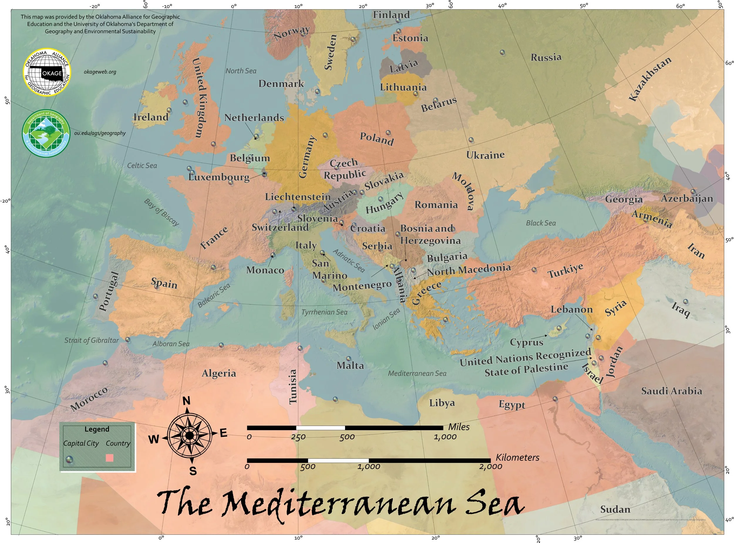
Click on the image to download a map of countries surrounding the Mediterranean Sea. This map was created by Noah Holderbaum, OKAGE Student Assistant. The default size for printed copies of this map is three feet by four feet.

Click on the image to download a political map of the Caribbean Islands. This map was created by Noah Holderbaum, OKAGE Student Assistant. The default size for printed copies of this map is three feet by four feet.

Click on the image to download a political map of Europe. This map was created by the University of Oklahoma Center for Spatial Analysis. The default size for printed copies of this map is three feet by four feet.

Click on the image to download a political map of Africa. This map was created by the University of Oklahoma Center for Spatial Analysis. The default size for printed copies of this map is three feet by four feet.

Click on the image to download a political map of the Middle East. This map was created by the University of Oklahoma Center for Spatial Analysis. The default size for printed copies of this map is three feet by four feet.

Click on the image to download a physical map of Central America. This map was created by the University of Oklahoma Center for Spatial Analysis. The default size for printed copies of this map is three feet by four feet.

Click on the image to download a political map of Central America. This map was created by the University of Oklahoma Center for Spatial Analysis. The default size for printed copies of this map is three feet by four feet.

Click on the image to download a satellite map of Central America. This map was created by the University of Oklahoma Center for Spatial Analysis. The default size for printed copies of this map is three feet by four feet.

Click on the image to download a physical map of South America. This map was created by the University of Oklahoma Center for Spatial Analysis. The default size for printed copies of this map is four feet by three feet.

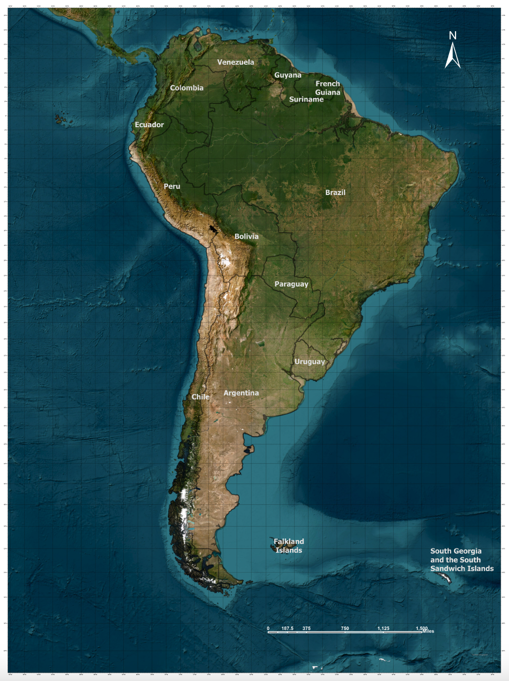
Click on the image to download a political map of South America. This map was created by the University of Oklahoma Center for Spatial Analysis. The default size for printed copies of this map is four feet by three feet.
Click on the image to download a satellite map of South America. This map was created by the University of Oklahoma Center for Spatial Analysis. The default size for printed copies of this map is four feet by three feet.

Click on the image to download a satellite map of East Asia. This map was created by the University of Oklahoma Center for Spatial Analysis. The default size for printed copies of this map is three feet by four feet.
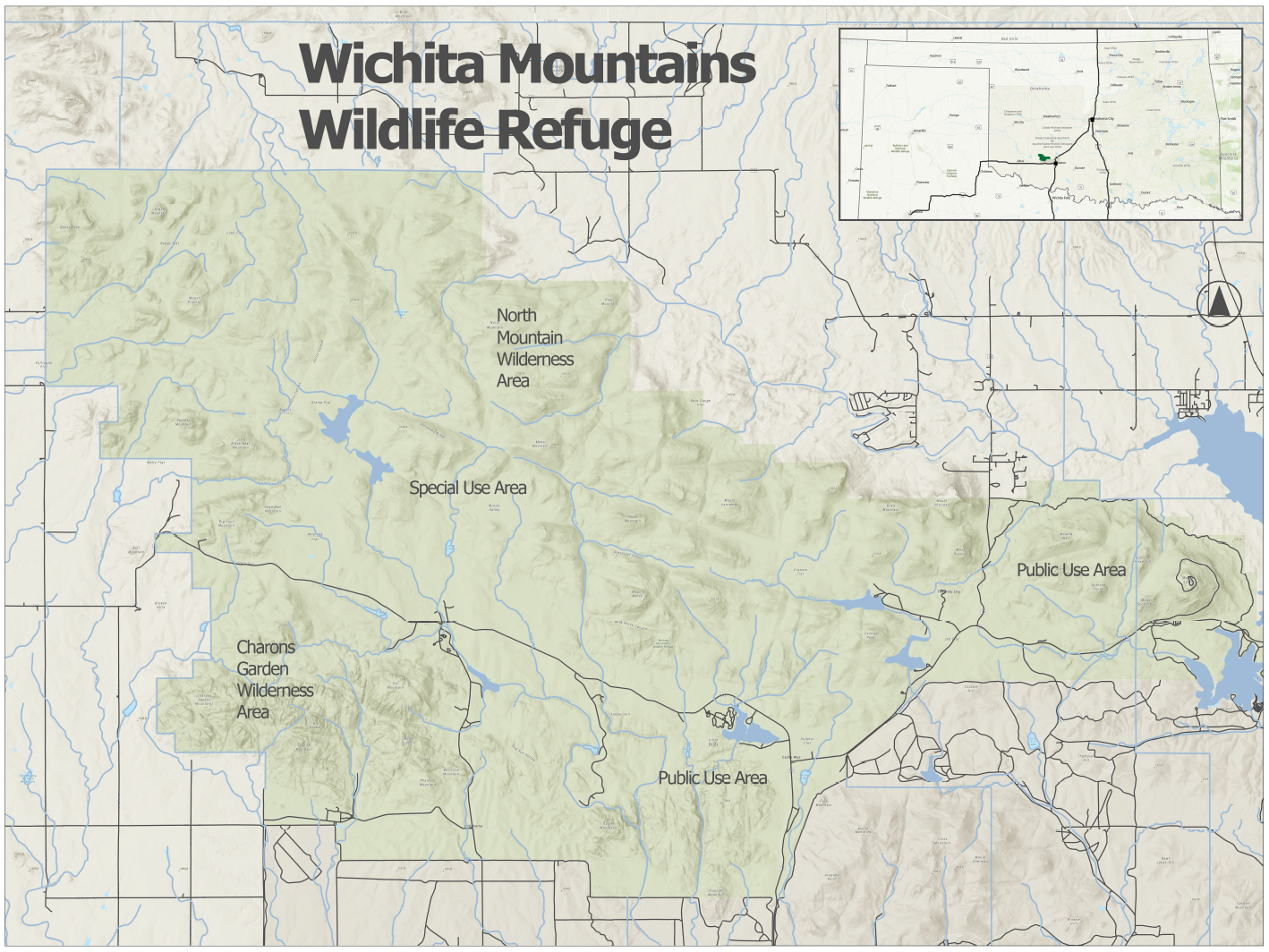
Click on the image to download a map of the Wichita Mountains Wildlife Refuge. This map was created by the University of Oklahoma Center for Spatial Analysis. The default size for printed copies of this map is sixteen inches by twenty inches.

Click on the image to download a map of Jamestown. This map was created by the University of Oklahoma Center for Spatial Analysis. The default size for printed copies of this map is sixteen inches by twenty inches.

Click on the image to download a street map of the city of Tulsa. This map was created by Noah Holderbaum, OKAGE Student Assistant. The default size for printed copies of this map is three feet by four feet.
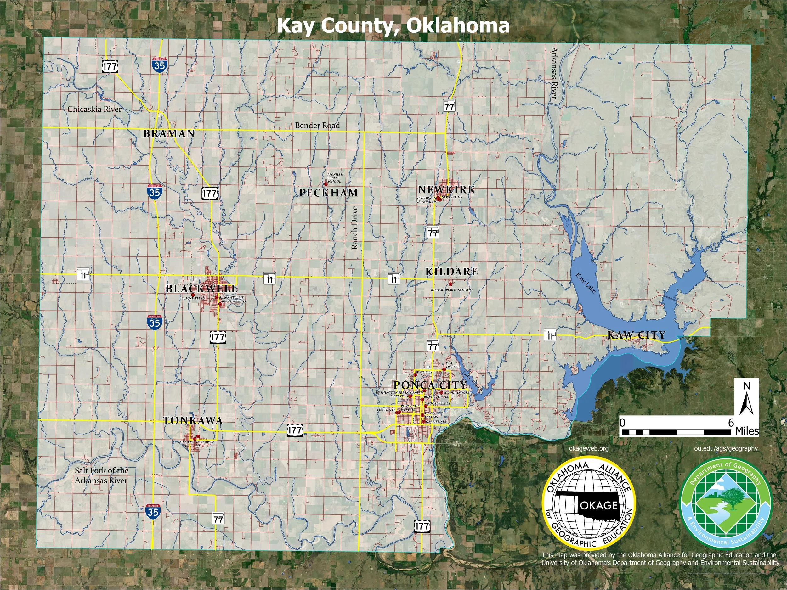
Click on the image to download a map of Kay County, Oklahoma. This map was created by Noah Holderbaum, OKAGE Student Assistant. The default size for printed copies of this map is four feet by three feet.
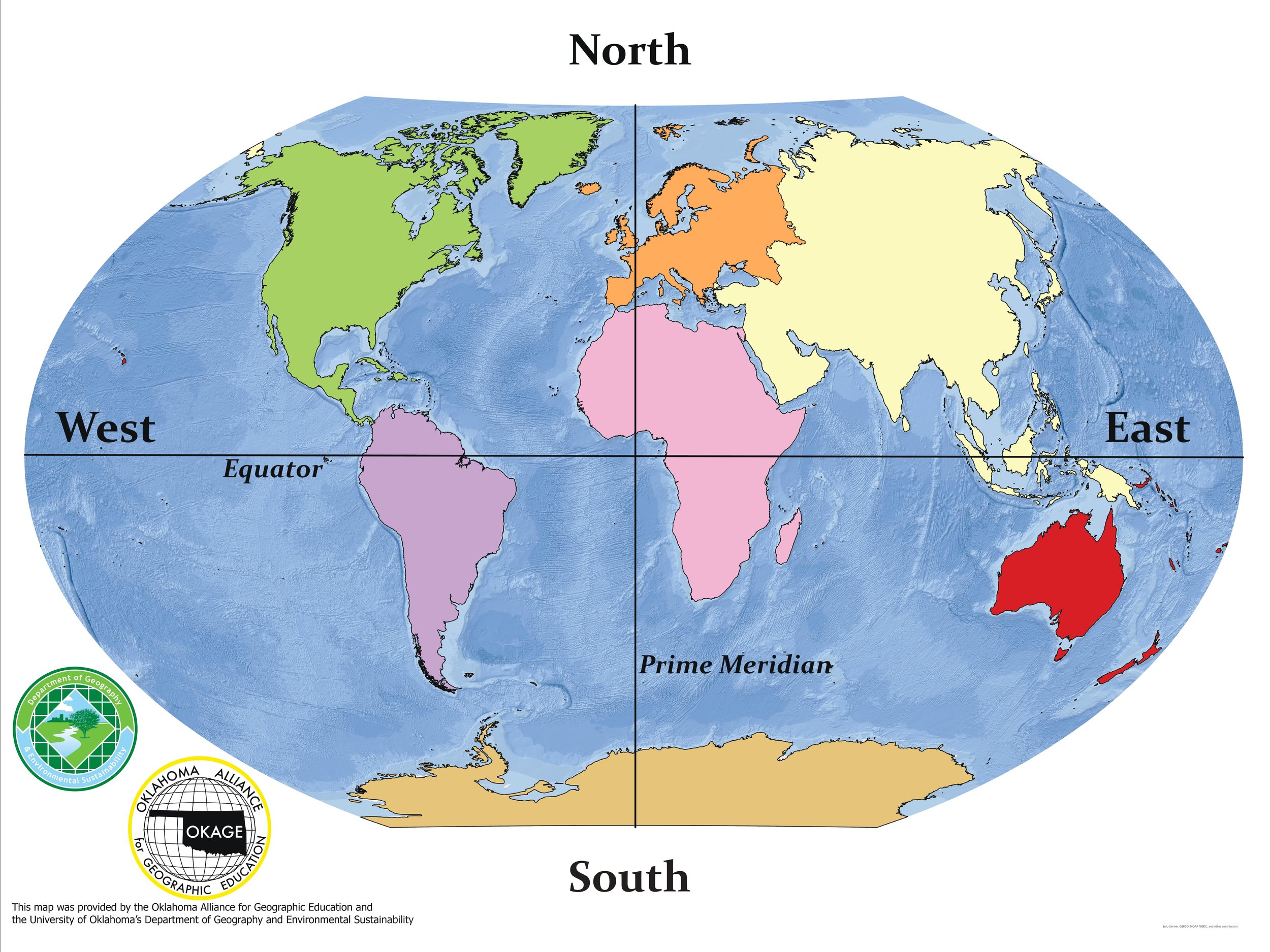
Click on the image to download an unlabeled continents map. This map was created by Noah Holderbaum, OKAGE Student Assistant. The default size for printed copies of this map is four feet by three feet.
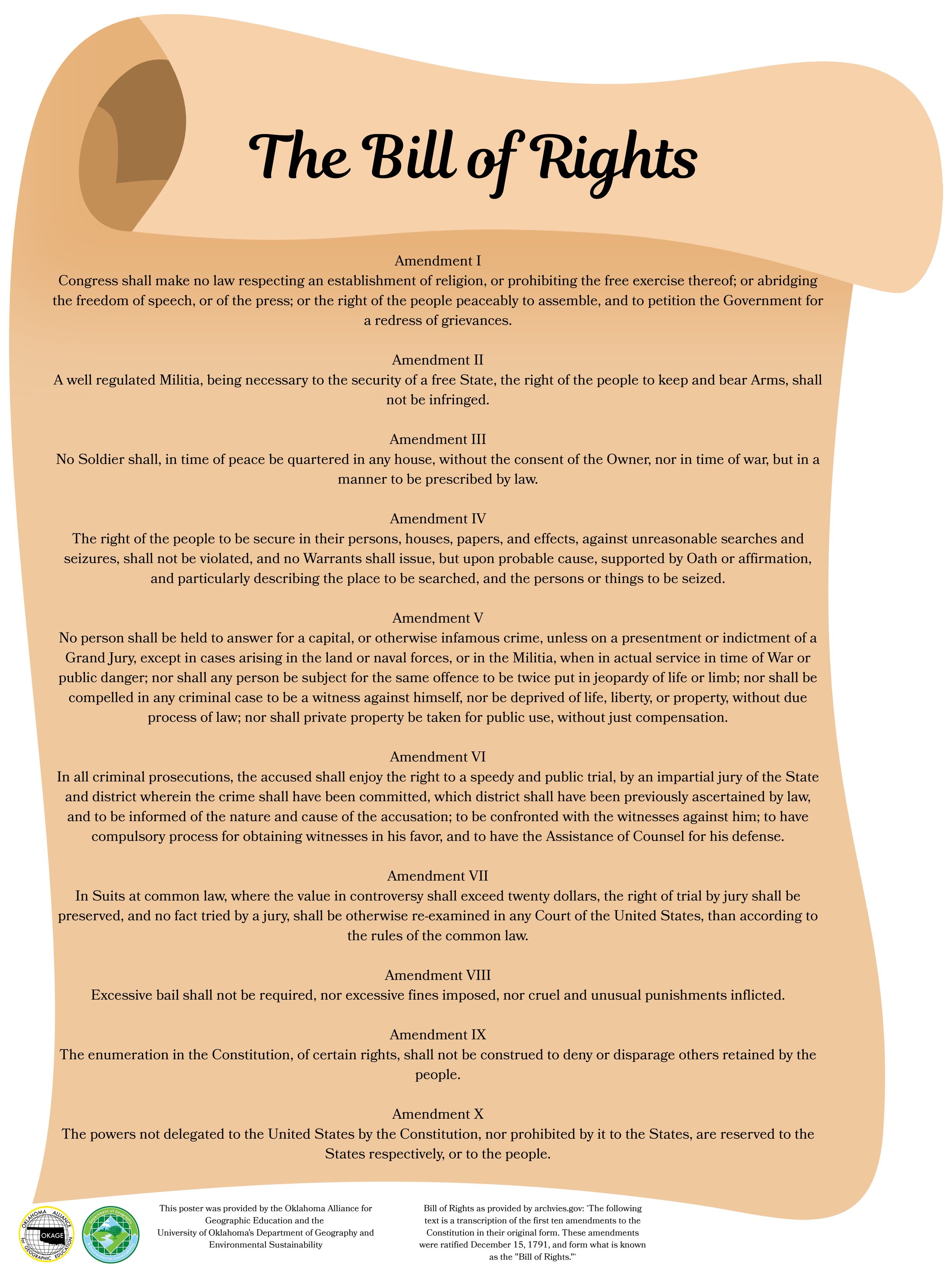
Click on the image to download a Bill of Rights poster for use in Government courses. This poster was created by Noah Holderbaum, OKAGE Student Assistant. The default size for printed copies of this map is three feet by four feet.